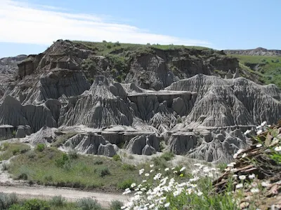
The main reason for the exogenous force is to create new topographies on the crust as well as bring changes in the structure of the figures. Under this, there are combined activities of weathering and erosion.
Many figures are formed as a result of weathering and erosion, mainly U-shaped valley, V-shaped valley, alluvial Features include alluvial plume, loess, barkhan etc. Brief information is given below about the shapes made related to these activities.
Important Shapes
- Kshiprika – The smaller structure than the waterfall is called Kshiprika.
- Alluvial feathers – The rivers coming out of the mountain parts spread the sediments far and wide in the shape of wings, as a result of which the Giripad plain or Terai is formed.
- Alluvial Cone – When the rivers leave behind the sediments of the rocks while coming from the mountainous parts to the flat plains, then the Alluvial Cone is formed. As a result of this, Bhabar region is formed.
- River Visarp – River Visarp is formed when the rivers move left and right in the plains.
- Slurry Pore – As a result of the dissolving action of water, many small pores are formed on the surface, then it is called Slurry Pore.
- Solution Pore – Deep solution pore is called solution pore.
- Doline – The wide shaped solution pore is called Doline.
- Yuvala – The wide shape made up of several dolines is called Yuvala.
- Lapis or Clint – As a result of hydrolysis and dissolving action, the surface becomes very rough, which is called Clint or Lapiz.
- Terra Rosa – Due to the solution action, a thin layer of soil is formed on the surface, which is called Terra Rosa.
- Dry Valley and Blind Valley – In karst areas, the water of the rivers seeps down through the solution holes, as a result of which the front valley is called Dry Valley and the back valley is called Blind Valley.
- Poliye or Polje – Shapes larger than Yuvala, such as Livno (the largest) in the Balkan region, are called Poliye or Polje.
- Stalactite – Kandraos are formed as a result of underground water. Due to the dripping of water in these caves, deposits of lime stored on the roof of the cave keep floating, which is called stalactite.
- Stalagmite – Unlike stalactite, when the deposit of lime (lime stored) is on the floor, it is called Stalagmite.
- Kandara Pillar – Kandara Pillar is formed by the fusion of stalactite and stalagmite. These activities are formed as a result of weathering and erosion.
- Stack – Remaining part like column in the sea, they are formed by fragmentation of arches.
- Cliff or Bhrigu – A standing beach is called Cliff or Bhrigu.
- Snowflake or Sark – After the removal of the glacier, the part made of armchair shape is called Snowflake or Sark.
- Hanging or Suspended valley – The valley of the tributary glacier appears to be hanging over the valley of the main glacier, hence it is called Hanging or suspended valley.
- Nunatak – Despite the glaciation, the high mounds of rocks that have come out are called Nunatak.
- Sheep Rock – While coming down from the barrier rocks by the glaciers, sharp and rough slopes are made by breaking them, which are called Sheep Rock.
- Inselberg or Bornhart – Domed mound of rocks formed as a result of wind erosion is called Inselberg or Bornhart.
- Jyugen – As a result of horizontal erosion of soft and hard rocks, an inkpot shape is formed, which is called Jyugen.
- Seif – When the sand stupa is made parallel to the direction of the wind, then its two sides have steep slopes. In Sahara it is called Seif.
- Barkhan – Sand stupa is made perpendicular to the direction of the wind, so the slope of the direction from which the wind comes is slow and the slope of the other side is steep. In Turkmenistan it is called Barkhan.
- Loyas – The area made up of fine sand particles blown by the wind is called Loyas. On getting water in this soil, it becomes highly fertile. For example – Northern Plain of China – It is made of fine sand particles blown from Gobi desert and its color is yellow due to oxidation.
- Playa – In the desert regions, the surface made of alluvium, which once had a lake, is called Playa. If the rift gets filled in it, the playa lake is formed.
- Salanas – Playa lake of salt water is called Salanas.
- Bajada or Bahada – Alluvial feathers of the desert are called Bajada or Bahada.
- Basin or Balsan – The low land area surrounded by mountains in desert regions is called Basin or Balsan.

Comments
Post a Comment